पाताले छाँगो
Historic photograph of Devi’s Fall, Pokhara

Nepal → Gandaki Province → Pokhara → Devi’s Fall Pokhara

Devi’s Fall Pokhara · पाताले छाँगो · Patale Chhango · Travel Guide

Pokhara · Chhorepatan

Devi’s
Fall

Devi’s Fall Pokhara (पाताले छाँगो / Patale Chhango) — Pokhara, Nepal

Water from the Phewa Lake drainage drops into a rocky gorge and continues underground. Learn about the landscape while checking current access before planning a journey.

Google Maps listed this waterfall as temporarily closed when checked on 26 October 2026. No current management notice confirming the reason or reopening date has been verified.

Maps: temporarily closed · 26 Oct 2026Reopening unconfirmed4.0/5 · 21,540 external reviews
ABOUT THE FALL

About Devi’s Fall Pokhara
(पाताले छाँगो / Patale Chhango)

Devi’s Fall, Davis Falls and Patale Chhango refer to the waterfall in Chhorepatan, Pokhara. Nepal Tourism Board identifies the Phewa Lake drainage as its source and describes its path through rocks, caves and tunnels.

Google Maps listed this waterfall as temporarily closed when checked on 26 October 2026. No current management notice confirming the reason or reopening date has been verified.

Current access
Google Maps listed this waterfall as temporarily closed when checked on 26 October 2026. No current management notice confirming the reason or reopening date has been verified.
Hours and admission
No current opening hours, fee or reopening date has been independently confirmed. The former daily timetable is not a current promise.
Location
Chhorepatan, H10, Pokhara; map place point 28.1895642, 83.9586637.
Photographs
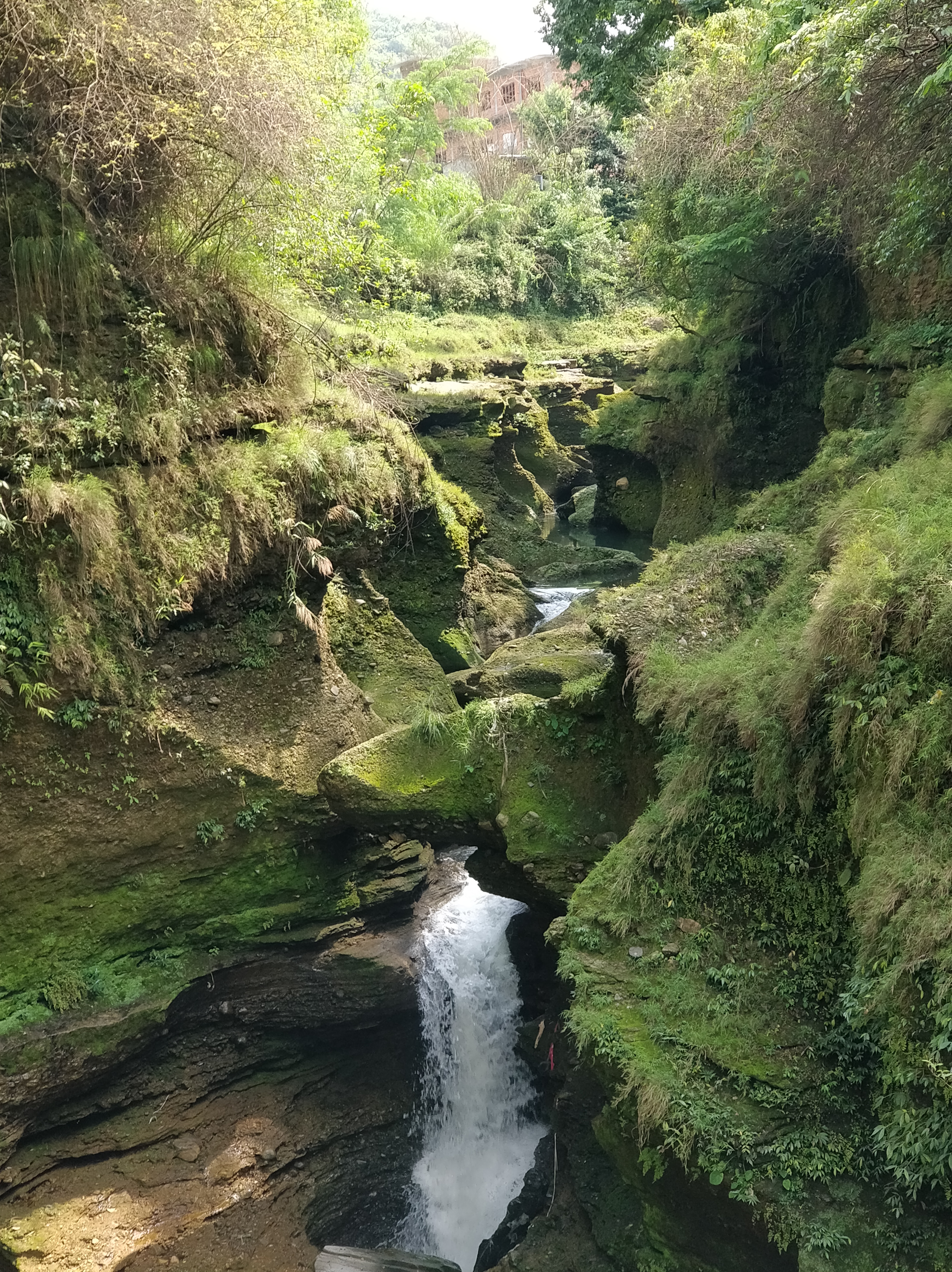
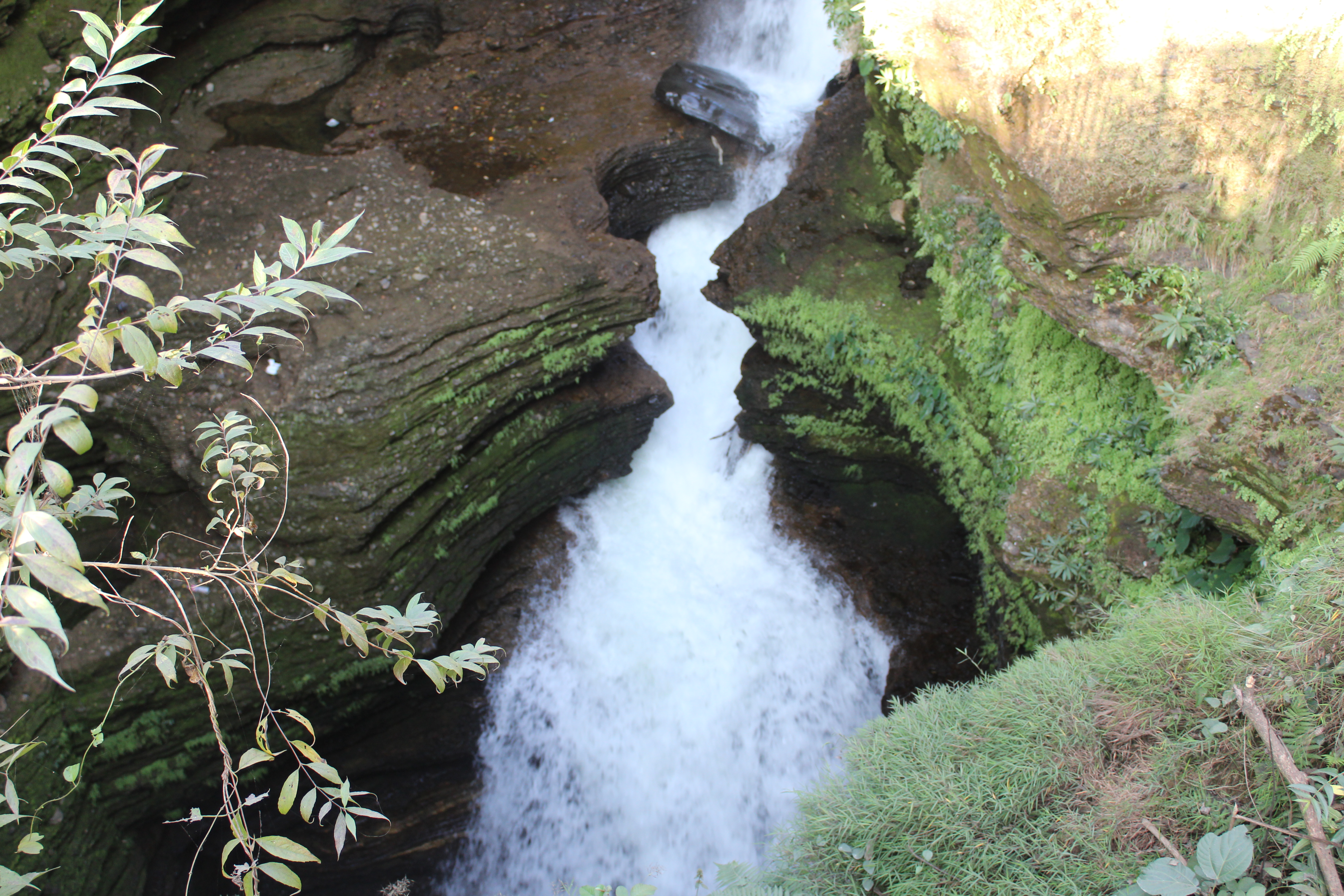
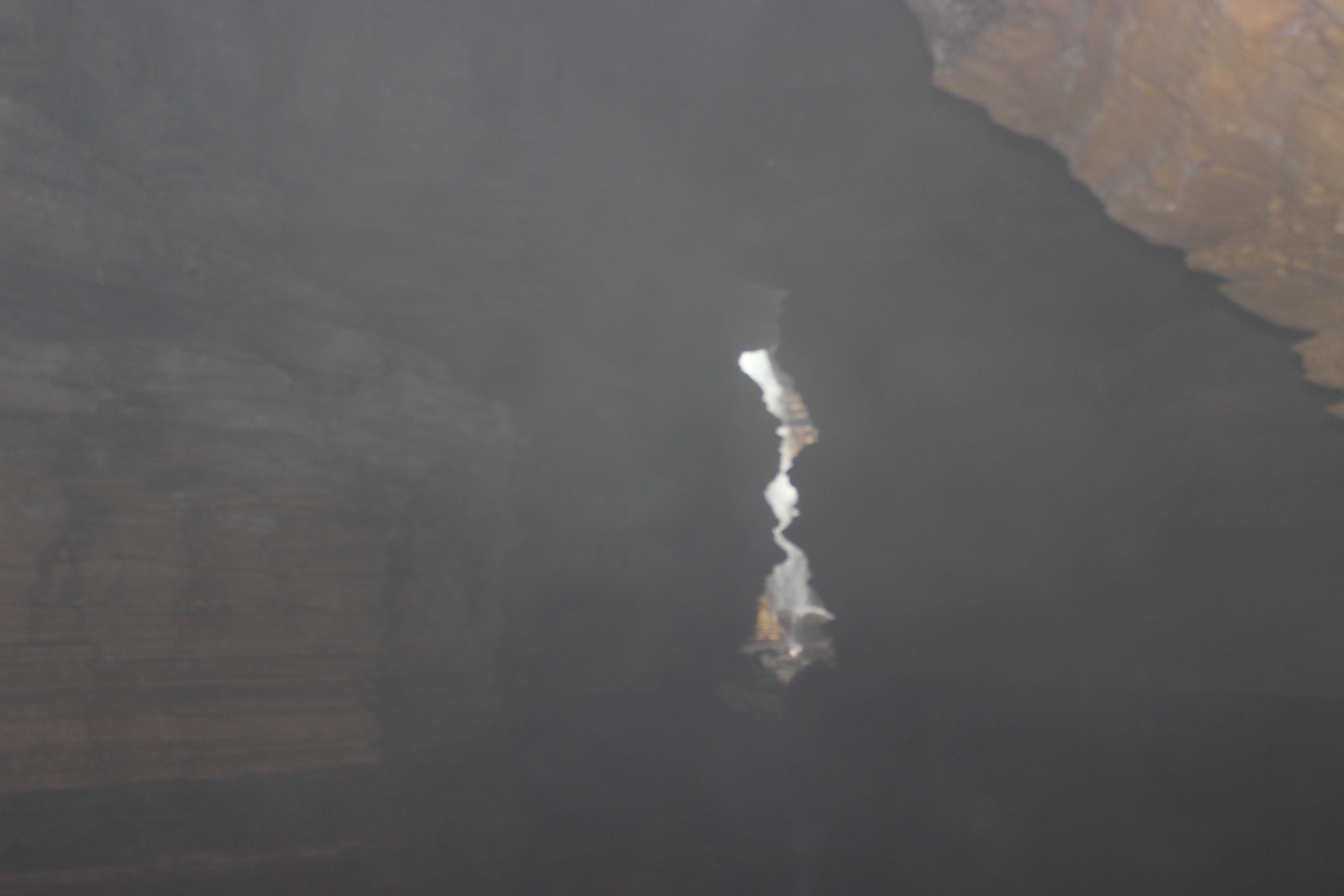
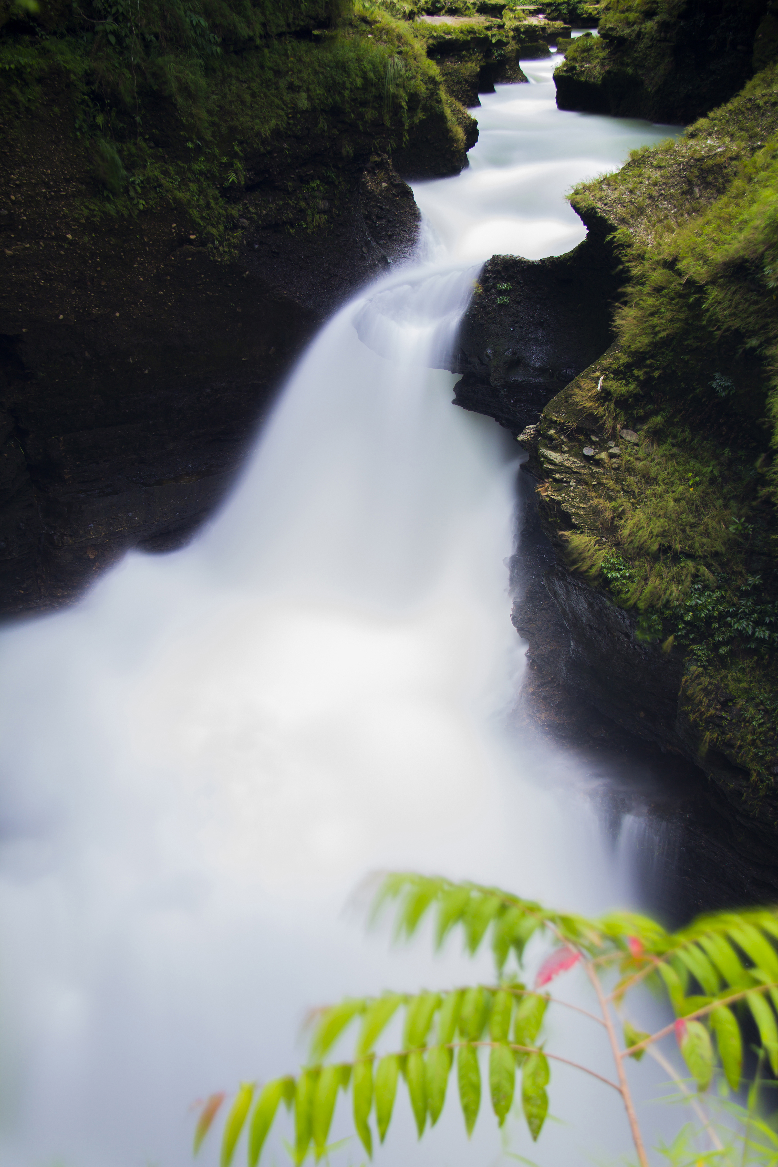
The four photographs show scenes from 2013 and 2018; they do not establish present water flow or access.
Separate attraction
Gupteshwar Mahadev Cave is described by NTB on the other side of the fall; its own opening or ticket sales do not prove waterfall access.

Devi’s Fall Pokhara · Chhorepatan, H10, Pokhara 33700. Google Maps listing: +9779805889741, 4.0/5 and 21,540 reviews checked 26 October 2026; contact not independently verified as management.

What makes it different

Not a fall that drops down,
but one that goes underground.

NTB describes water from Phewa Lake cutting through rocks into caves and tunnels. This diagram explains that general relationship; it is not a measured underground survey or an invitation to enter the watercourse.

≈

Rock strata

Erosion-cut layers, a narrow gorge and a deep cavity are the main visual elements.

↓

Hidden waterway

The water vanishes from the surface and continues through a natural tunnel-like underground passage.

Phewa drainage · schematic
Steep drop through the narrow gorge
Natural underground passage
Plan your visit

Check access first,
then decide your route

Access

Temporary closure listed

Google Maps listed this waterfall as temporarily closed when checked on 26 October 2026. No current management notice confirming the reason or reopening date has been verified.

A third-party listing, not a management explanation.

Fees and time

Confirm before travelling

Do not rely on old ticket rates or an old 06:00–18:00 timetable. No current admission offer or reopening has been verified.

Parking and assistance

Arrangements unconfirmed

Dedicated parking, accessible routes and assistance have not been confirmed for a current visit. Ask the responsible site management before making transport arrangements.

Recommended order

Prepare a conditional plan,
without assuming entry

Google Maps listed this waterfall as temporarily closed when checked on 26 October 2026. No current management notice confirming the reason or reopening date has been verified.

  1. 01

    Verify access

    Seek a current management confirmation, including the date and the areas actually open.

  2. 02

    Choose transport

    Use the exact waterfall map point; agree on route, fare and return arrangements instead of assuming a short fixed journey.

  3. 03

    Respect barriers

    If closed, do not enter. For any permitted visit, obey signs and keep away from wet rock, water edges and restricted sections.

  4. 04

    Check other sites separately

    Cave, museum or pagoda access and tickets must be checked independently; no combined visit or admission is guaranteed.

Scenes

Water, rock and a dark gorge

Historical scenes,2013/2018. Flow and access vary; these photographs are not a live status report. See individual authors, dates and licences in Photo credits.

Getting there in detail

Locate the waterfall,
confirm access before travel

Taxi or ride

Ask for Devi’s Fall / Patale Chhango in Chhorepatan. Confirm current access first, then agree on route, price, luggage needs and return pickup. No fixed journey time is promised.

Public transport

Check a current service and stop with the operator before boarding; this guide has not verified a present bus timetable or fare.

Independent travel

Review the actual route and permitted drop-off or parking. A map pin identifies the destination but does not establish an open gate or safe access.

Address: 5XQ5+HP2, H10, Pokhara, Gandaki Province 33700, Nepal
Maps-listed phone, unverified: +977 980-5889741

Map place point 28.1895642, 83.9586637. The listed phone is from Maps; management identity and current response have not been verified.

Source scope

NTB describes the destination; it does not publish a current reopening notice here.
Nepal Tourism Board — Davi’s Fall & Gupteshwar
Pokhara Tourism Council — Caves & Devi’s Fall

The map is set to the Nepali language / Nepal region.

Open in Google Maps ↗
Nearby

Other destinations to check separately

Across the road

Gupteshwor Mahadev Cave

A separate destination to consider only after checking its own opening, ticket and mobility arrangements. Its availability does not confirm access to the waterfall.

Pokhara city

International Mountain Museum

A separate destination to consider only after checking its own opening, ticket and mobility arrangements. Its availability does not confirm access to the waterfall.

Hill view

World Peace Pagoda

A separate destination to consider only after checking its own opening, ticket and mobility arrangements. Its availability does not confirm access to the waterfall.

Food nearby

Grab a light bite
right in Chhorepatan

No current cafés, menus or opening hours have been verified by this guide. Select a meal stop only after checking its address, dietary suitability, price and transport.

Before choosing a venue

Confirm the actual address and whether it is open on your date.

Match your needs

Ask about dietary needs and plan the return journey; no named venue is endorsed here.

History & local meaning

A story in the name,
reality in the geography

Nepal Tourism Board describes the local name Patale Chhango and connects the English name with a Swiss woman swept away in1961. Treat the account as attributed history; spellings vary and this guide does not establish a more precise event date.

NTB links the waterfall’s Phewa Lake source with caves and tunnels, including Gupteshwar on the other side. This geographical description and historical photos do not establish present admission.

Landscape / “architecture” character

Main natural feature
A narrow rock gorge, erosion-opened layers, a steep drop and an underground waterway.
Human-made parts
Historic photographs show viewing structures; their present condition and availability must be confirmed.
Key caution
The water’s force can be stronger than expected. Do not cross the railing, climb wet rock or enter closed sections.
Photo tips

Keep the spray,
show the depth

The photographs explain possible compositions, not current access or flow. Do not seek a photo from a closed or restricted area. If admission is later confirmed, follow barriers and site photography rules.

Main angle

Angled view from above

For a confirmed permitted visit only: follow the actual signs, safe viewing boundaries and staff instructions; conditions may differ from historic photos.

Monsoon

Carry a lens cloth

For a confirmed permitted visit only: follow the actual signs, safe viewing boundaries and staff instructions; conditions may differ from historic photos.

Cave

Religious-area rules

For a confirmed permitted visit only: follow the actual signs, safe viewing boundaries and staff instructions; conditions may differ from historic photos.

Stay

Use Lakeside as base

Compare accommodation areas against your actual route, rates, availability and mobility needs. This guide has not verified current hotels or a short journey from them.

FAQ

Before you go,
short answers

Google Maps listed this waterfall as temporarily closed when checked on 26 October 2026. No current management notice confirming the reason or reopening date has been verified.

Is Devi’s Fall open now?+

Google Maps listed this waterfall as temporarily closed when checked on 26 October 2026. No current management notice confirming the reason or reopening date has been verified.

What are the current opening hours?+

No current opening timetable or reopening date has been confirmed. Do not rely on old daily hours while Maps shows a temporary closure.

How much is admission?+

No current admission price or active ticket offer has been independently verified. Check management confirmation of access and then the applicable fee and concession conditions.

Does cave opening prove waterfall entry?+

No. Gupteshwar is a separate attraction. Its hours, tickets and tour sales do not establish waterfall access or a shared ticket.

How should I plan travel from Lakeside?+

Ask for Devi’s Fall / Patale Chhango in Chhorepatan. Confirm current access first, then agree on route, price, luggage needs and return pickup. No fixed journey time is promised.

Are the different names the same place?+

Devi’s Fall, Davis Falls and Patale Chhango are names used for this Chhorepatan waterfall. Confirm the exact map point rather than relying on spelling alone.

Why is it closed and when will it reopen?+

The dated Maps notice supplies neither a reason nor a reopening date, and no current management confirmation has been verified. Older closure reports do not establish today’s cause.

Sources

Where the info comes from
Dated source roles

Nepal Tourism Board — Davi’s Fall & Gupteshwar↗Pokhara Tourism Council — Caves & Devi’s Fall↗Devi’s Fall Pokhara on Google Maps↗

Checked 26 October 2026: NTB supports destination/history; Google Maps supplies the dated closure listing and place point. Neither has supplied a verified current reopening or fee notice in the sources read.

Individual author, source, licence, historical date and crop notices are in Photo credits.

Privacy

Your data

This information site has no accounts, bookings or contact forms. Google Maps loads separately and uses Google’s own policies.

GA4 may start immediately after permission is successfully stored and verified. Cookie settings lets you withdraw; it cannot recall data already sent. Local storage records the choice; a session refusal helps keep this tab off after a storage failure. Failure feedback explains whether a stored grant may remain.

Hosting may process technical request logs and inject an independent Cloudflare performance beacon. The GA choice does not control that beacon; script presence alone does not prove a particular visit transmitted data. The service worker caches same-origin pages and resources for offline use.

Google · Cloudflare performance data

Terms of use

Travel information

Google Maps listed this waterfall as temporarily closed when checked on 26 October 2026. No current management notice confirming the reason or reopening date has been verified.

Do not travel expecting admission from an old timetable, ticket list or a nearby cave/tour offer. Check current management information; this guide sells no tickets and guarantees no admission, accessibility or journey time.

Respect closures, barriers and staff instructions. Historical photographs and sourced landscape descriptions are not current safety or opening assessments.

Photo credits

Photos from the actual site

Saroj Pandey · CC BY-SA 3.0
Devi’s Fall in full monsoon flow, Pokhara · 2013-07-28
Licence terms

Harsh Mahaseth · CC BY-SA 4.0
Devi’s Fall rock gorge and narrow channel · 2018-05-16
Licence terms

Nabin845 · CC BY-SA 4.0
Water entering the narrow underground channel at Devi’s Fall · 2018-11-25
Licence terms

Rajivkilanashrestha · CC BY-SA 3.0
Devi’s Fall watercourse viewed from Gupteshwor Mahadev Cave · 2013-01-17
Licence terms

Four original Commons photographs show 2013/2018 scenes. CSS crops their display; the files are retained byte-for-byte. Each image remains under its individual CC BY-SA licence.

Individual author, source, licence, historical date and crop notices are in Photo credits.

Sources

Sources and dates

Nepal Tourism Board — Davi’s Fall & Gupteshwar ↗Pokhara Tourism Council — Caves & Devi’s Fall ↗Devi’s Fall Pokhara — Google Maps ↗

Checked 26 October 2026: NTB supports destination/history; Google Maps supplies the dated closure listing and place point. Neither has supplied a verified current reopening or fee notice in the sources read.